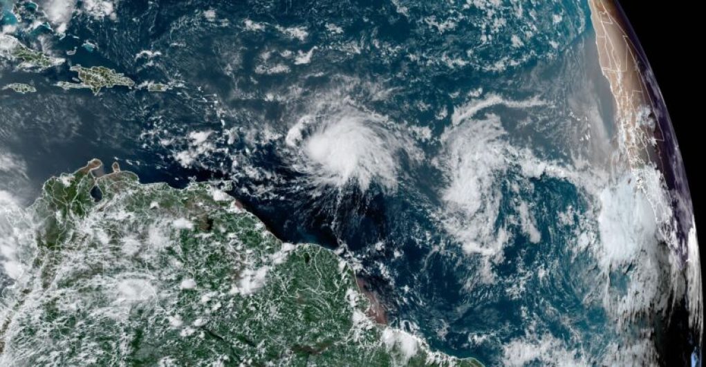
Hold on tight, folks, because planet Earth is experiencing some seriously disturbing weather and climate trends right now. The Antarctic sea ice is at a record low, with current measurements showing it’s far below any previous year since 1981. Meanwhile, Texas is sweltering under a dome of high pressure, with temperatures reaching record highs across the state. And that’s not all – the Atlantic Ocean is heating up, with Tropical Storm Bret nearing hurricane strength and another tropical wave close behind.
But what’s causing all of this chaos? It’s no secret that greenhouse emissions are contributing to a warming world, and these trends are consistent with that theory. In fact, sea surface temperatures in the Atlantic’s main development region are warmer now than they’ve ever been in June, with the oceans as warm as they would be in a typical August.
So what does this mean for the rest of the hurricane season? It’s hard to say, but with the bulk of the season’s activity occurring from mid-August to mid-October, it’s a bit worrisome to think about how conducive the seas will be to hurricanes by then. However, a strengthening El Niño in the Pacific should increase wind shear over the Atlantic this summer, which could help to mitigate the damage.
As a coastal resident in Texas, I’m definitely rooting for shear. But for now, let’s keep a close eye on these trends and hope for the best.
Early August-like conditions have been observed in the Atlantic tropics, prompting intense speculation over the potential impacts of the region’s extreme warmth.
Recent satellite images have revealed that most of the tropical Atlantic Ocean is experiencing anomalously high temperatures, with the region from the northern Caribbean to the coast of Texas currently registering temperatures at least 3°C (5.4°F) above average. While temperatures this high are not unprecedented for this region during the mid-summer months, it is unusual to find such extensive warmth as early as this, with ocean temperatures peaking much higher than normal.
At the center of the anomalous warmth is an exceptionally strong subtropical ridge. This atmospheric feature diverts atmospheric energy away from the tropics, typically suppressing cyclone activity and keeping storms from gathering strength. The high temperatures could be the harbinger of a hot and dry fall across the Caribbean and the southern Atlantic coast- eventualities which would have both direct and cascading implications.
The most immediate threat posed by the present conditions is that of increased potential for destructive hurricanes. While the anomalously high temperatures do not in and of themselves result in an increase in hurricane frequency, they can serve to create conditions that further embolden already forming storms. Hotter-than-normal surface temperatures combine with warm water at depth to provide storms with the energy they require to grow stronger and larger than normal.
If the trend of warm tropical temperatures continues through the end of the hurricane season, the consequences could be dire. Areas most vulnerable to hurricanes such as the Caribbean and the Gulf Coast will be at increased risk of destruction from storms that form and intensify quickly, and would find it difficult to prepare for such an event.
Ongoing ocean surface and structure monitoring by satellites and instrumented ships, as well as advanced weather and climate models, will provide insight into how long these anomalous conditions may continue. Until then, coastal and landlocked populations will have to await further developments with caution.


